
THE OBJECTIVE
The project focuses on the Hills of the Muses, or Philopappou, of the Pnyx and of the Nymphs, or of the Observatory. The primary objective is to collect and integrate on a single cartographic background part of the fragmented archaeological and other documentation material concerning the Hills and the surrounding area. The study and recording of the historical transformations that went under way are based on cartographic methods and the collection of evidence.
In terms of cartography, information is drawn from the early maps of the city of Athens, aerial photos, urban planning diagrams, drawings of archaeological studies and contemporary orthophoto maps. The user may superimpose the various digitalised layers upon earlier and later historical maps in order to combine and compare them.
With regard to the documentation and for the purpose of understanding the historical transformations in the area of the Hills, these are being recorded in the early travellers’ narratives and illustrations, in historical studies on the Western Hills and the wider area, in archaeological publications and in the bibliography of a wider field of interest.
The project is designed in a way that, as we make progress concerning the understanding of cartographic signs in their spatial and historical framework, its scope may widen through the digitalisation of new research data, for instance, by locating the exact position of inscriptions cut on the surfaces of the rocks.
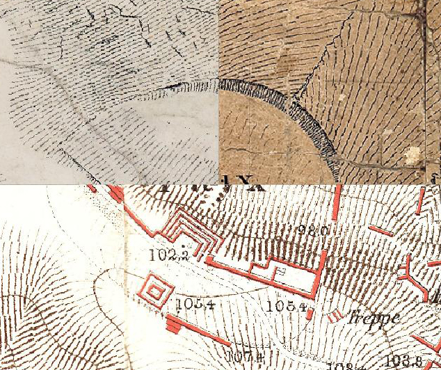
The Pnyx as depicted on different cartographic documents. Top left, on the map by Kleanthis and Schaubert (1832-1832); top right, on the map by Weiler (1834); bottom, on the map by Curtius and Kaupert (1878).