
Historical Maps
The Western Hills have been delineated on plenty historical maps of Athens, three of which have been used as backgrounds for the scope of this study. The selection criteria for these particular maps were the time they were created, the geographical precision with which they were drawn and the depiction of the state of the archaeological remains.
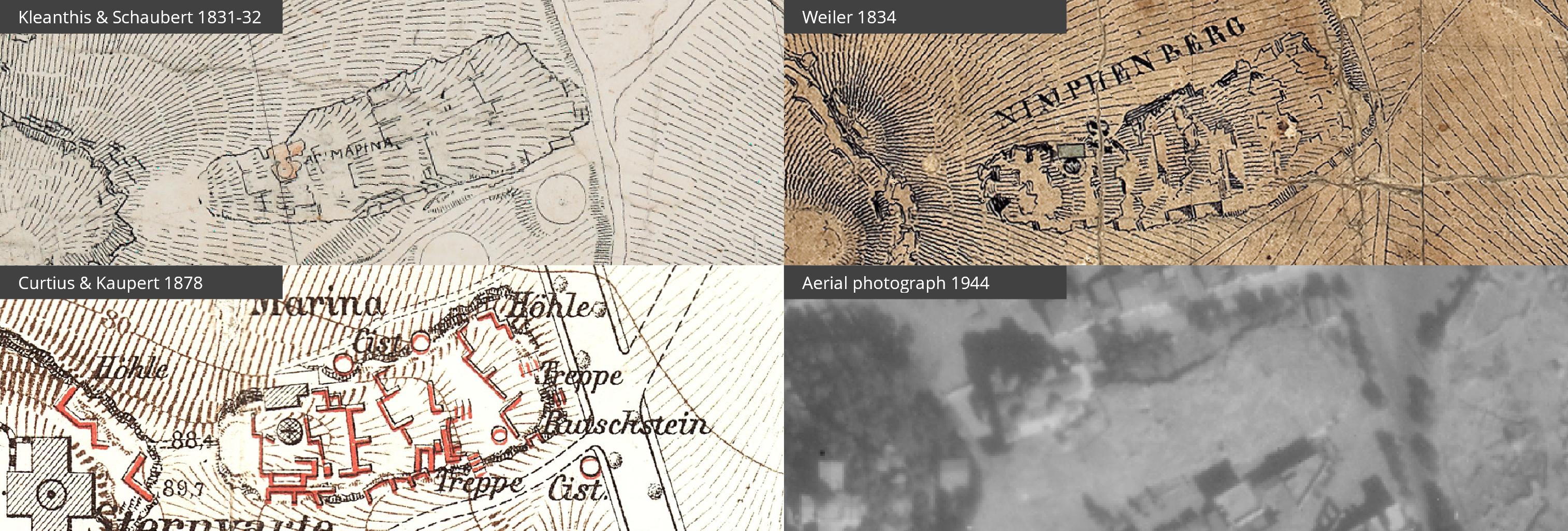
The map by Stamatis Kleanthis and Eduard Schaubert (1831-1832) is the earliest and most spatially precise representation of the Western Hills and contains many signs designating the archaeological remains. The map by Wilhelm von Weiler (1834) provides an analytical view of the relief and combines the clear delineation of the geographical limits of the Hills. The map by Ernst Curtius and Johann August Kaupert (1878), which was the springboard for the present study, is valuable on account of its diligent recording and annotation of the archaeological remains.
Historical maps, such as that of William Martin Leake (1841), of Ferdinand Aldenhoven (1837), of Emmanuel Kallergis (1860) and others, are equally precious evidence for the study of the wider Athenian topography; however, they were not used in the project because the area under scrutiny was not depicted in such a detail that would add to the already existing data. The map drawn by Émile Burnouf 1849 is a special case: Although it depicts extensively the archaeological remains upon the Western Hills, unfortunately it contains geographical disparities that render its georeferencing an impossible task. Nonetheless, due to the valuable information it provides, the map is available here, along with the accompanying treatise translated into Greek.
In addition to the historical maps, an aerial photograph was employed, taken by the Allied Forces (1944) from flight T4 and kept in the British School at Athens – Aerial Photograph Collection. The photo is an intermediate testimony from 1878 until today and demonstrates, among other things, the evolution of quarrying and of the road network during modern times.