
Ancient Remains
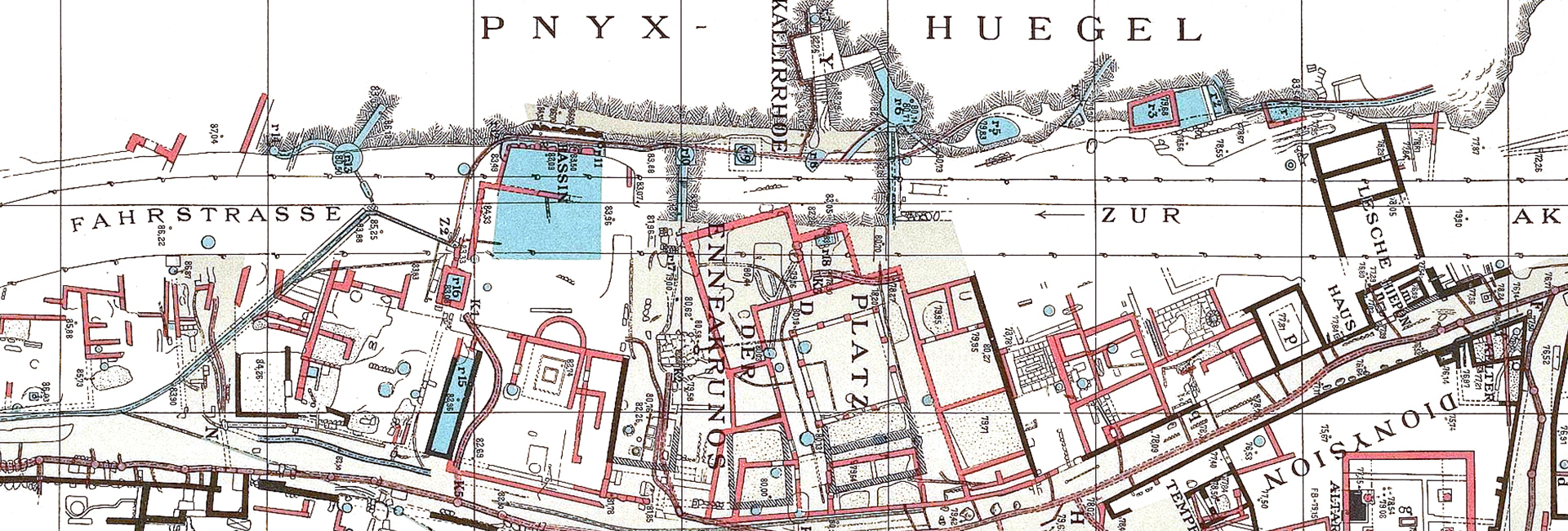
Cartographic signs. The cartographic signs of ancient structures and relief formations on the maps by Kleanthis and Schaubert (1831-1832) and Curtius and Kaupert (1878) are transformed into independent vector data. In this manner, it is possible to superimpose the data separately and/or simultaneously upon any historical and contemporary available background, highlighting, thus, the value of the possibility of a combined view of the data.
Archaeological drawings. Old and recent archaeological research, both within the limits of the archaeological site and around the wider area, brought into light traces attesting to the fact that the Western Hills have been constantly in use through time. Published drawings of architectural remains accruing from excavations, as well as of visible remains that were found by individual researchers are digitalised for the purpose of collecting archaeological data in an integrated cartographic system. It is therefore possible to search for ancient structures and relief formations that are not accessible any longer, for they were either filled up or destroyed. Even so, they are preserved in the depictions of early archaeologists and cartographers.
The walls. The course of fortification walls in the wider area of the Western Hills forms the spatial and historical framework of the mapped antiquities. The area was protected by the Themistoklean Wall (479/8 B.C.) immediately after the Persian Wars. Since the mid-5th century B.C., the Long Walls made sure the city was connected with Piraeus that meanwhile had become the main port of Athens. The Compartment Wall (diateichisma) was built in the early Hellenistic period on the ridge of the three Western Hills and was the westernmost boundary of the city throughout antiquity. The ancient walls in the area were designed according to the reconstructions suggested by Walther Judeich (1905, 1931) and John Travlos (1971), with regard to the Themistoklean Wall and the Long Walls, and by Homer A. Thompson and Robert L. Scranton (1942) as regards the Compartment Wall (diateichisma) and the Macedonian Fort.
Roads. The ancient roads are part of an organised communication system and bear immense significance both for the daily commuting of persons and the development of economic activity. According to Herodotos (6.103), one of the most commercial and frequented streets of Athens was the “Koile road” through which passed those travellers coming from Piraeus via the Long Walls. The deep wheel ruts are still preserved right where carriages were passing through daily, carrying merchandise from the port to the Ancient Agora. On the Hills another network of smaller streets with stairs is depicted, leading to the densely populated quarters that nested on their slopes.